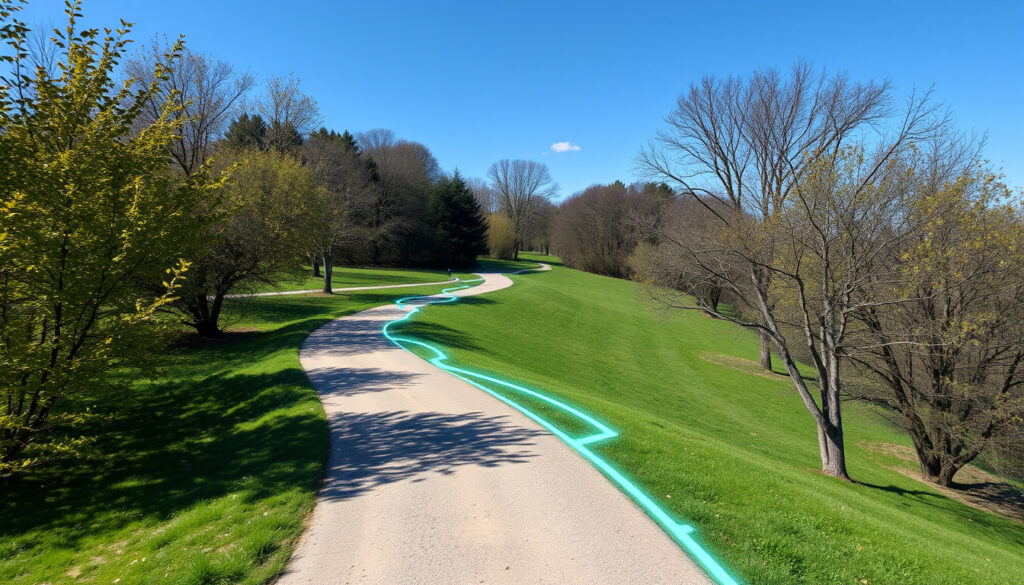
How Far Did I Run – Best Free Tools for Accurate Measurement
Whether you are preparing for your first 5K or logging daily miles, knowing exactly how far you ran matters. Free route planning tools and GPS tracking applications now make it possible to measure running distances with impressive accuracy, often without spending a penny.
This guide examines the most effective free tools for calculating how far you ran, compares their features, and explains what factors influence measurement accuracy. From straightforward map interfaces to feature-rich tracking apps, runners have more options than ever to capture their distance data.
Understanding the capabilities and limitations of each tool helps you choose the right approach for your training goals, whether you prefer planning routes in advance or recording runs in real time.
How Far Did I Run? Best Tools to Measure Distance
Several free applications and web-based tools can help you determine your running distance. The right choice depends on whether you need to plan a route before you run, track a run as it happens, or calculate distance after the fact.
Quick Comparison: Top Free Route Planning Tools
For pre-planned routes, On The Go Map and PlotARoute offer the simplest interfaces. For real-time tracking, Strava provides the most comprehensive free metrics.
| Tool | Free Access | Units (mi/km) | Elevation Data | Primary Use |
|---|---|---|---|---|
| Google Maps | Yes | Both | Limited | Route planning |
| On The Go Map | Yes | Both | Yes | Route planning |
| PlotARoute | Yes | Both | Yes | Route planning |
| Strava | Yes | Both | Yes | Live tracking |
| MapTools | Yes | Multiple | Calculated | Distance calculation |
Key Insights for Accurate Distance Measurement
- On The Go Map requires no account creation and automatically snaps routes to roads and trails suitable for running, avoiding high-traffic areas where possible.
- PlotARoute allows you to specify desired distance and generates route suggestions accordingly, useful for training runs of specific lengths.
- MapTools employs the Haversine formula, which accounts for Earth’s curvature when calculating straight-line distances, providing precision for longer routes.
- GPS-based tools like Strava typically show distance variance of 2-5% compared to actual road measurements in open areas.
- Urban environments with tall buildings can reduce GPS accuracy, sometimes resulting in 5-10% distance overestimation.
- GPX file export enables transferring planned routes to Garmin devices and other GPS watches for guided running.
- Strava’s heat maps reveal the most frequently used routes in your area, helping identify popular training paths.
Common Running Distance Conversions
| Distance Type | Miles | Kilometres |
|---|---|---|
| 5K | 3.1 miles | 5 km |
| 6 Mile Run | 6 miles | 9.7 km |
| 10K | 6.2 miles | 10 km |
| Half Marathon | 13.1 miles | 21.1 km |
| Marathon | 26.2 miles | 42.2 km |
Map My Run for Free: Top Route Planners
While Map My Run offers robust features, several free alternatives provide comparable capabilities for runners working within a budget. These tools range from simple map interfaces to comprehensive tracking platforms.
Web-Based Route Planners
Google Maps remains one of the most accessible options for basic route planning. You enter your starting point and destination, then drag the cursor along roads to adjust the path while viewing total distance and turn-by-turn directions. The platform works more effectively on desktop computers, though you can send completed routes to your smartphone for navigation during runs.
The service lacks elevation profiles and surface type information, making it less suitable for trail runners seeking terrain details. It also does not support exporting route files directly to GPS watches, which limits its utility for athletes using dedicated devices.
PlotARoute distinguishes itself as a free tool designed specifically for walks, runs, and bike rides on or off-road surfaces. The platform offers full control over route planning and can generate suggestions based on your desired distance. This makes it particularly valuable for runners training for specific race distances who want to visualize their route before heading out.
Mobile-Friendly Mapping Tools
On The Go Map earns recognition as one of the simplest run mapping tools available. The service requires no sign-up process and includes an automatic “snap” feature that routes you along roads and trails suitable for running rather than busy thoroughfares. This navigation intelligence proves especially useful in areas with limited dedicated running paths.
MapTools Measure Distance provides multiple unit conversions including miles, kilometres, metres, yards, nautical miles, and feet. The tool estimates walking, running, and cycling times, and allows routes to be exported as GPX files compatible with Garmin devices or importable into Strava and Komoot.
Feature-Rich Alternatives
Beyond basic planners, several platforms offer expanded functionality. Komoot, Garmin Connect, Footpath, and AllTrails represent additional options recommended for runners seeking comprehensive route information. AllTrails specifically provides user reviews and ratings for each route, helping runners identify the best paths in unfamiliar areas.
For trail runs and countryside routes in the United Kingdom, OS Maps offers detailed mapping but requires a £29.99 annual subscription. Free alternatives like On The Go Map and PlotARoute provide adequate coverage for most urban and suburban running routes.
How Accurate Is ‘How Far Did I Run’ Measurement?
Understanding the accuracy of distance measurement tools helps runners interpret their data correctly and set realistic expectations for training metrics.
GPS Tracking Accuracy Factors
GPS-based distance tracking performs most accurately in open areas with clear sky visibility. Under these conditions, most tracking applications achieve accuracy within 2-5% of actual distance covered. However, several environmental factors can reduce this precision.
Urban canyons created by tall buildings interfere with satellite signals, sometimes causing 5-10% distance overestimation. Dense tree cover similarly affects accuracy for trail runners. Signal multipath interference, where buildings reflect GPS signals, can add apparent distance to your recorded route.
Manual Mapping Versus GPS Tracking
Route planners like PlotARoute and On The Go Map calculate distance based on your drawn path along actual roads and trails. This manual approach generally produces highly certain distance measurements because the route follows verified geographic features.
GPS tracking applications record your position at regular intervals, then calculate distance between recorded points. The accuracy of this method depends on the device’s GPS chip quality and the frequency of position updates. Map My Run demonstrates distance tracking accuracy comparable to high-end GPS devices, though results vary across different applications and devices.
Understanding Pace Calculation
Pace calculations combine distance and time data, meaning any error in distance measurement propagates to pace figures. A 5% distance overestimation would show a correspondingly slower average pace than actually achieved. Most serious training applications address this through smoothing algorithms, but runners should understand that displayed pace represents an approximation.
No free tracking application can guarantee exact distance measurement. Environmental factors, device quality, and satellite conditions all influence recorded data. For race training purposes, treat distance figures as estimates rather than absolute values.
How Far Did I Run Today? Track Time and Speed
Beyond basic distance measurement, many runners want to understand their time and speed metrics during and after each run. Free tools offer varying levels of detail in these areas.
Real-Time Tracking Features
Strava provides free users comprehensive metrics including distance, average pace, moving time, elevation gain, and calories burned. These features make it popular among runners who want detailed performance data without paying for premium subscriptions.
Premium Strava subscribers gain access to advanced route planning features allowing preferences for distance, terrain type, elevation levels, and foot traffic density. The platform’s heat maps showing frequently used routes help runners discover popular paths in their area or when travelling.
Calculating Time and Speed
Understanding the relationship between distance, time, and speed helps runners track progress over time. Average pace represents the time taken to cover one mile or kilometre, while speed indicates distance covered per unit of time.
MapTools provides time estimates for walking, running, and cycling activities, helping runners plan how long a planned route should take. These estimates typically assume consistent effort and moderate pacing, which may not reflect individual fitness levels or terrain challenges.
Performance Analysis Over Time
Map My Run offers detailed metrics including cadence, stride length, and performance charts over time. These analytical features help runners identify trends in their training and make informed decisions about pacing strategy. For those interested in international rugby, you can find the latest Rugby World Cup rankings here: Rugby World Cup rankings.
Most tracking platforms maintain a library of recorded runs, enabling comparison between sessions. This historical data proves valuable for measuring fitness improvements, tracking recovery from injury, and preparing for upcoming race events.
Distance Conversion Tools
Runners frequently need to convert between miles and kilometres, particularly when comparing training plans from different countries or preparing for international events. The 5K distance equals 3.1 miles, while a 10K corresponds to 6.2 miles. MapTools allows switching between measurement units without requiring account creation or limiting the number of conversions.
Evolution of Running Route Planning Tools
Distance tracking technology has progressed significantly over the past two decades, transforming how runners plan and record their training.
- Early GPS Devices (2000s): Bulky wristwatch units offered basic distance tracking with limited battery life and accuracy issues in urban areas.
- Smartphone GPS Apps (2010s): Smartphone integration brought sophisticated tracking to everyday devices, with apps like Strava gaining millions of users.
- Web-Based Route Planners (2010s): Services like On The Go Map and PlotARoute emerged, offering free route planning without requiring app installation.
- Social Integration (2010s-2020s): Platforms added social features, allowing runners to share routes, join challenges, and follow friends’ activities.
- Comprehensive Fitness Ecosystems (2020s): Current tools combine route planning, live tracking, performance analysis, and social features in unified platforms.
What We Know and What Remains Unclear About Distance Tracking
GPS accuracy varies by environment and device. Open areas typically yield 2-5% variance, while urban settings may show 5-10% deviation from actual distance.
| Established Information | Information That Remains Unclear |
|---|---|
| Free route planners exist for web and mobile | Long-term accuracy consistency across devices |
| GPS tracking shows 2-10% variance based on conditions | Standardized accuracy testing methodology |
| Manual mapping provides certain distance figures | How firmware updates affect tracking precision |
| Unit conversion tools operate without errors | Best practices for comparing data across platforms |
| Strava and Map My Run offer comprehensive free tiers | Future feature availability in free versions |
| GPX export works across major platforms | Optimal sampling rates for specific activities |
Understanding Running Distance Measurement in Context
Running distance measurement serves multiple purposes beyond simple curiosity. Competitive runners need accurate data for training load management, while recreational joggers may simply want to track progress or share achievements with friends.
The proliferation of free tools has democratized access to sophisticated tracking capabilities previously available only through expensive devices or subscriptions. This accessibility encourages more people to engage in regular running activity by providing tangible metrics for motivation and accountability.
Choosing between pre-run route planning and post-run distance calculation depends largely on training goals. Runners preparing for specific events benefit from planning routes of exact distances, while those focused on general fitness may prefer simply recording whatever distance their chosen path provides.
What Experts and Tools Say About Route Planning
Google Maps represents one of the simplest options for planning running routes, allowing users to enter starting points and destinations while adjusting routes and viewing total distance.
— Runner’s World
On The Go Map requires no sign-up and automatically routes you along roads and trails suitable for running rather than high-traffic areas.
— Running Community Resources
Map My Run provides distance tracking accuracy comparable to high-end GPS devices, offering detailed metrics including cadence, stride length, and performance trends over time.
— Tech Fitness Reviews
Getting Started with Distance Tracking
Selecting the right distance tracking approach depends on your specific needs, whether that involves planning tomorrow’s route, recording today’s run, or converting distances between units for an upcoming race.
For pre-planned routes, On The Go Map and PlotARoute offer straightforward interfaces without requiring account creation. For live tracking with social features, Strava provides the most comprehensive free tier among major platforms.
Those interested in wearable technology integration may find our comparison of Apple Watch SE 2024 – Release Date, Price, Sizes, Colors useful for understanding how smartwatches complement running tracking applications. Similarly, runners seeking to connect fitness activity with broader health outcomes can explore our guide on How to Lower Blood Pressure – Proven Natural Strategies.
Frequently Asked Questions
What is the average time to run 5K?
Average recreational runner times for a 5K range from 25 to 35 minutes. Competitive runners typically complete 5K events in under 20 minutes.
How do I calculate running pace from distance and time?
Divide total running time in minutes by distance in miles or kilometres. For example, 30 minutes divided by 3 miles equals a 10-minute mile pace.
What is the distance of the Great North Run?
The Great North Run covers 13.1 miles (21.1 km), making it a half marathon distance event held annually between Newcastle and South Shields in England.
Can I use Google Maps to track my run in real time?
Google Maps works better for planning routes in advance rather than live tracking. Dedicated apps like Strava offer superior real-time tracking with automatic pause and resume features.
How accurate is smartphone GPS for running?
Modern smartphone GPS typically achieves 2-5% accuracy in open areas. Urban environments with tall buildings may reduce this to 5-10% variance.
What does GPX file format mean?
GPX (GPS Exchange Format) is a standard XML format for sharing GPS data between devices and applications. Most running watches and fitness apps support GPX import and export.
How do I export a planned route to my Garmin watch?
Use a route planner like PlotARoute or MapTools to create your route, export it as a GPX file, then upload the file to Garmin Connect or Garmin Express for transfer to your device.
More related posts
 Bank of England Base Rate History – Timeline from 1694
 Conor Benn vs Eubank Jr 2 – Full Fight Results and Highlights
 Julia Donaldson – Books, Biography & Adaptations
 6 Inch in CM – Exact Conversion to 15.24 Centimeters
 Scottish Mortgage Investment Trust – Holdings, Performance & NAV Guide
 William Baldwin – Biography, Movies, and Net Worth
 Foreign and Colonial Share Price – Now Shows Fresnillo Data
 Ozzy Osbourne Villa Park – Confirmed Facts and History
